

Leave Sonoma County early, coffee in the cup and a full day ahead, and the first question usually isn't “Which trail is prettiest?” It's “How far can we drive before the hike starts, and can we camp afterward if everyone wants to stay out longer?” That distinction matters. The United States has an unusually extensive trail system, with roughly 88,600 miles of national trails, including scenic, historic, recreation, and connecting routes. More than 230 million people live within 60 miles of a National Trail, so substantial outdoor access often starts much closer to home than it first appears. (Pacific Crest Trail Association)
This roundup starts with practical escapes from Sonoma County, then moves toward coastal, redwood, and alpine trips that make more sense as overnight plans. Each entry covers the trail character, likely difficulty, camping reality, seasons, permits, family fit, amenities, access tactics, operating information, address planning, and what recent visitor feedback is most useful for assessing.
Treat the drive times as planning estimates, not promises. Traffic, ferry schedules, road closures, fog, and weekend parking can change the day. Sonoma County Navigator is a reader-supported local guide for finding regional outings, lodging, food, parks, and other activities when a trail day turns into a longer trip.
Planning rule: Pick the drive first, then choose the trail. A beautiful route that leaves your group exhausted before the hike begins isn't a successful day trip.
1. Redwood Regional Preserve in the Oakland Hills
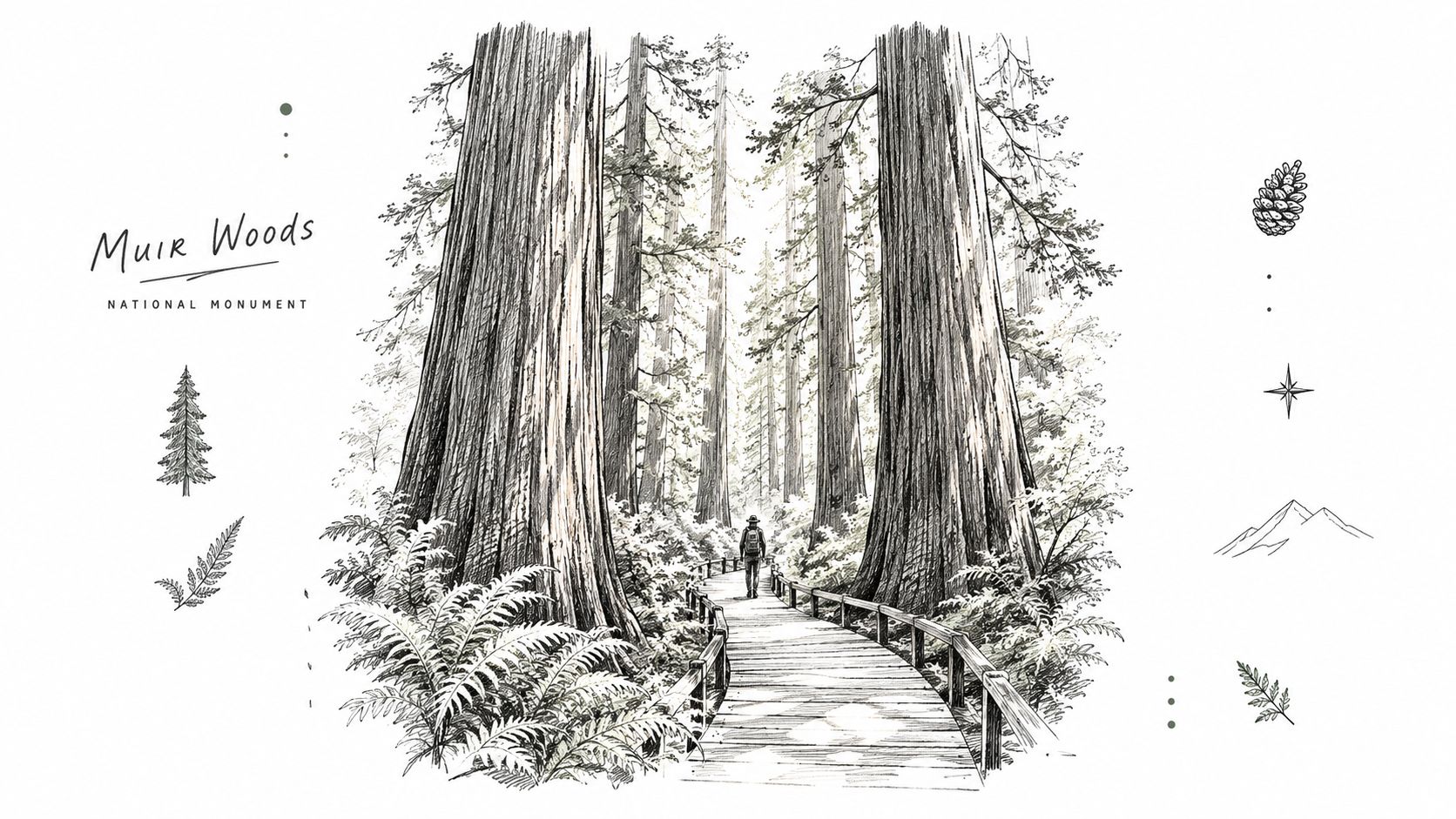
Redwood Regional Preserve gives Sonoma County hikers a genuine redwood outing without requiring a coastal overnight. Allow roughly 90 minutes in light traffic, and leave early on weekends. Bay Area congestion can erase the advantage of the relatively short drive.
The preserve works well for mixed-ability groups. Lower trails are shaded and enclosed, while higher routes open onto broad East Bay views. Douglas fir, madrone, and oak woodland add variety, so the experience feels broader than a single redwood corridor.
Start with the Redwood Trail Loop if the goal is immersive forest scenery and a manageable family hike. Stronger hikers can continue toward the East Ridge Trail or connect with nearby Oakland Hills routes. The trade-off is climbing. Short-looking map distances can become tiring once repeated ascents and descents add up.
Practical details before you leave
- Difficulty and distance: The Redwood Trail Loop is roughly 2 to 3 easy miles on shaded, mostly level tread. Adding the East Ridge Trail pushes the day past 6 miles and 1,000 feet of climbing, making it a better choice for conditioned hikers.
- Camping: Plan on a day hike unless the current park authority confirms a legal camping option. A quiet forest clearing does not mean overnight use is allowed.
- Season and weather: Begin in the morning for cooler temperatures and clearer views. Summer hikers should carry insect repellent and prepare for changing fog.
- Access and amenities: Download an offline AllTrails map before entering the preserve. Arrive early for easier parking, and bring food and water because trailhead services are limited.
- Hours, address, and reviews: Confirm current operating hours, the official entrance address, parking rules, and closures before departure. Recent reviews can reveal current parking pressure, muddy sections, and trail conditions.
Best fit: Choose Redwood Regional Preserve for flexible redwood walking, forest shade, and route options within a day-trip drive. Choose another destination if your group needs a guaranteed campground or extensive on-site services.
2. Big Sur Julia Pfeiffer Burns State Park
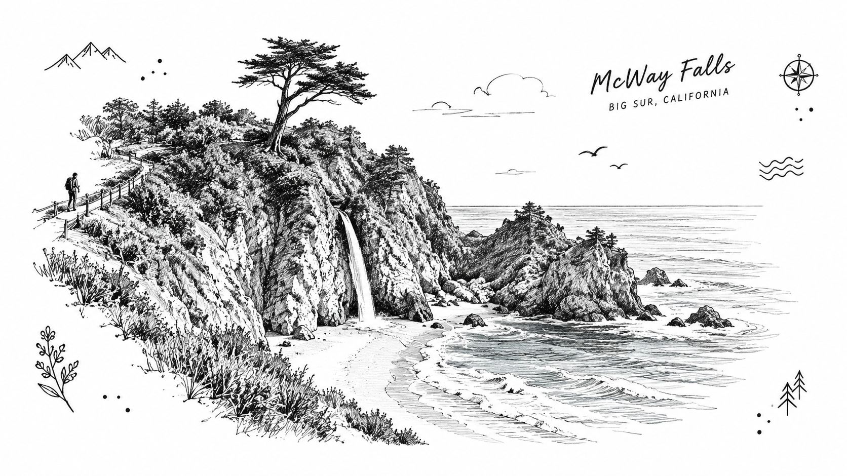
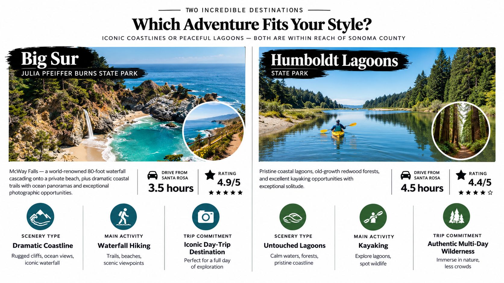
Julia Pfeiffer Burns State Park is a committed trip from Sonoma County, roughly three and a half hours south in favorable conditions. Highway 1 traffic, road work, and coastal closures can stretch that drive, so plan it as an overnight destination rather than a casual day outing.
The park rewards a slower itinerary. Redwood canyons lead toward coastal bluffs and ocean viewpoints, while McWay Falls provides the signature stop. Families and mixed-ability groups can focus on short scenic walks, though longer canyon and bluff routes require more time, sturdy footwear, and attention to changing conditions. Elevation varies by route, so check the current trail description before choosing a longer outing.
Best fit: Choose Julia Pfeiffer Burns for dramatic scenery and a planned coastal escape. It suits hikers who value views over mileage and groups willing to accept limited camping flexibility.
Plan the overnight before the trail day
Pfeiffer Big Sur State Park campground is the practical nearby option. Confirm reservations well ahead of summer weekends, then check campground rules, vehicle access, fire restrictions, and any permit requirements. Julia Pfeiffer Burns State Park is primarily a day-use stop for this itinerary, so improvised overnight camping is not an option.
Shoulder-season and mid-week visits can reduce crowd pressure. Early morning and late afternoon offer softer coastal light, while weather and road conditions can change quickly. Carry water, food, and a headlight for a delayed return, but do not extend the day onto unfamiliar coastal trails after official closing time.
Before leaving, verify the park's current operating hours, entrance address, parking arrangements, restrooms, trail closures, and recent visitor reviews. Those checks reveal access limits, road problems, and conditions that a scenic photograph cannot show. Food planning is easier with this Big Sur dining guide.
For a wider itinerary, compare the drive and overnight commitment with Sonoma County Navigator's weekend getaways from San Francisco guide. That comparison helps decide whether Big Sur fits one night or a longer coastal trip.
3. Angel Island State Park in Marin County
Angel Island is a quick Sonoma County escape with one firm constraint: the ferry. The drive to Tiburon can take about 45 minutes in light traffic, but the boat timetable controls the day. Arrive late, and the hike may need to shrink. Miss the return ferry, and the short outing becomes an overnight problem.
The island suits families and first-time campers who want an adventurous setting without a remote backcountry approach. Historic military sites, the former Immigration Station, Bay views, and open shoreline paths keep the experience varied. The Perimeter Trail offers manageable walking and broad scenery, while routes toward Mount Livermore add steeper climbing and more exposure to wind.
Build the itinerary around the ferry
Choose the perimeter route when the group wants an easy introduction or has limited time. Add Mount Livermore only when weather, daylight, and fitness allow. Sunset is appealing, but the return boat, remaining light, and route back to the landing must all line up.
Difficulty and distance: The perimeter route is the approachable choice. Ridge sections demand more effort and can feel exposed in strong wind. Plan extra time for stops at historic sites and viewpoints.
Camping: Island campsites are reservation-only through ReserveCalifornia and sit a mile or more uphill from the Ayala Cove ferry landing, so everything for the night has to be carried in one load. Confirm the campsite location, equipment requirements, and ferry schedule before booking.
Season and conditions: Weekdays usually make crowd management easier. Bring layers because Bay weather can change quickly, and check wind and visibility before committing to higher routes.
Tiburon provides a practical meal stop before or after the crossing. Binoculars are useful for bird and wildlife watching, while the island's limited services make a packed lunch and water sensible.
Before departure, check ferry times, park operating hours, the official landing and visitor address, camping reservations, permit requirements, restrooms, and trail closures. Recent visitor reviews can clarify whether people found the ferry connection, signage, and facilities manageable. Those checks also reveal access problems that a scenic photograph will not show.
Angel Island rewards groups that value history and scenery as much as mileage. It suits a planned day or reserved overnight, not a spontaneous late start.
4. Mount Tamalpais State Park in Marin County
Mount Tamalpais works well for a mixed-ability group, but the mountain rewards an early start. The drive from Sonoma County is roughly 80 minutes. Weekend traffic and limited summit parking can add pressure, so leave time for the approach rather than treating this as a quick after-breakfast outing.
Redwood forest, oak woodland, chaparral, and broad Bay Area views share the park. Families and casual walkers can choose shorter, gentler trails, while fit hikers can take on the Dipsea Trail, summit routes, or a longer loop. A combined Matt Davis-Steep Ravine-Dipsea loop runs roughly 6 to 8 miles with sustained climbing, according to the Mount Tamalpais State Park trail map. The route suits hikers who want a full-day effort, provided they are comfortable with uneven terrain and repeated climbs.
Planning takeaway: Choose the route before the climb, then set a meeting point for groups splitting between short walks and summit trails.
Fog changes the experience. East Peak may offer a less crowded alternative to the busiest summit approaches, while clear conditions make the higher viewpoints the main attraction. Winter weather can affect both roads and trail surfaces, so check conditions before leaving.
Camping is possible at nearby Pantoll Campground, subject to current reservations and park rules. Confirm whether the campsite, intended trailhead, and parking area line up, and check whether any permit or reservation requirement applies to your plan.
For families, the park is a good fit when adults select a manageable route and carry enough water. Amenities and reception can vary by area, so download a map before departure. Plan for limited parking, bring layers, and avoid relying on a last-minute space near the summit.
Before setting out, verify current operating hours, the official park address, trailhead access, parking restrictions, campground status, closures, restrooms, and permit requirements. Recent visitor reviews can help identify fog, road, crowding, and signage problems that scenic ratings often overlook. Mount Tam suits both a short scenic visit and a committed day hike, but the group should agree on distance and turnaround time first.
5. Point Lobos State Natural Reserve near Carmel

Point Lobos is about two and a half hours south of Sonoma County, best suited to a determined day trip or a Carmel overnight. Rocky coves, cypress groves, beaches, and marine wildlife make this a place for slow exploration rather than distance-driven hiking.
Start with the Cypress Grove Trail for the reserve's signature scenery. Other coastal paths range from easy walks to moderate routes with uneven ground and exposure near cliff edges. Elevation changes are generally secondary to footing, surf conditions, and frequent stops for photographs. Keep children well back from unstable edges and changing water.
Whale sightings are possible from December through May, although wildlife remains unpredictable. Early morning usually offers better light and a calmer start before weekend crowds build.
Planning takeaway: Reserve your day-use access when available, then arrive early enough to protect time for the coves and viewpoints.
Plan for a day-use reserve
- Access and parking: Arrive early or hold a day-use reservation, carry water, and bring a polarizing filter if seascape photography matters to you. The lot can fill before 10 a.m. on many weekends, and the gate may turn cars away.
- Camping: Point Lobos is primarily for daytime visits. Book lodging in Carmel or a legal campground elsewhere instead of expecting overnight camping inside the reserve.
- Family fit and amenities: Families can manage the shorter routes, while Carmel provides food, lodging, and other services nearby. Download route information before leaving, since reception and facilities can vary.
- Permits, hours, and address: Check the official entrance address, current operating hours, day-use reservation rules, parking limits, closures, restrooms, and any permit requirements before departure.
- Reviews: Recent visitor comments can reveal which coves are easiest with children, where parking fills first, and how crowds or weather affected access.
Point Lobos fits photographers, wildlife watchers, and families who prefer several short discoveries to one strenuous summit.
6. Humboldt Lagoons State Park in Humboldt County
Humboldt Lagoons State Park is a roughly four and a half hour drive north from Sonoma County, before adding stops, trail access, or an overnight stay. The park suits a committed coastal trip rather than a quick outing. Lagoons, salt marsh, forest, and open shoreline create a quieter setting where tide and weather influence the day.
Routes range from accessible shoreline exploration to less-developed hiking, with primitive camping and kayaking adding flexibility. Expect a remote, weather-exposed experience. Cold rain can arrive while the sky still looks inviting, and elevation changes, mud, wind, and water conditions can affect how far a family group comfortably travels.
A practical itinerary pairs the park with Patrick's Point State Park or another nearby stop. Late spring through early fall usually offers the easiest planning window, although rain gear belongs in every pack.
Make the overnight drive count
Start with the logistics before choosing a route:
- Trail choice and family fit: Match the outing to current trail descriptions, distance, elevation changes, surface conditions, and the experience of everyone in the group. Families may prefer shorter shoreline exploration over a less-developed route.
- Camping and permits: Primitive camping requires more equipment and self-sufficiency. Confirm campsite availability, reservation rules, fire restrictions, water guidance, and any permit requirements before leaving.
- Kayaking and seasons: Morning water may be calmer and offer better light, but check current conditions before launching. Pack rain gear even during the more comfortable travel season.
- Amenities and access tactics: Fuel and groceries in Trinidad or Orick before turning off Highway 101. The last stretch has no reliable cell coverage, so download maps and carry dry clothing, navigation tools, water, and emergency supplies.
- Address, hours, and reviews: Verify the official address for the intended entrance, operating hours, road conditions, camping status, closures, and facilities. Recent reviews can point out mud, wind, water access, parking conditions, and reception gaps.
Planning takeaway: Treat Humboldt Lagoons as an overnight coastal base, not a last-minute trail stop. Build in a weather backup and confirm camping before driving north.
7. Desolation Wilderness near Lake Tahoe
Lake Aloha can look like a straightforward destination on a map. From Sonoma County, the drive takes roughly three and a half hours before trailhead logistics, followed by route-finding, elevation gain, and possibly a hike to camp. That makes Desolation Wilderness a committed trip rather than a casual weekend stroll.
Granite basins, alpine lakes, and exposed terrain define the experience. Routes range from day hikes to multi-day backpacking, but elevation, pack weight, heat, smoke, storms, and snow can change the effort quickly. Hikers arriving from lower elevations should allow time to adjust before attempting a strenuous itinerary.
Plan the permit before the route
Desolation permits are quota-controlled by zone and issued through recreation.gov for the summer season. A separate day-use permit is required even for day hikes. Confirm the chosen zone's quota, campsite restrictions, and the overnight food-storage order before committing to Lake Aloha. A legal campsite is not guaranteed just because an attractive site appears beside the trail.
- Route, difficulty, and distance: Match the itinerary to elevation change, water availability, weather, and overnight equipment. A shorter route may suit a first visit, while experienced backpackers can use a three- or four-day plan to spread out the effort.
- Camping and seasons: Backcountry camping requires self-sufficiency and careful food storage. Summer can bring mosquitoes, while smoke, storms, and snow may affect other travel periods. Carry insect repellent, a map, and backup navigation.
- Family fit and amenities: This setting suits experienced backpackers and prepared day hikers more than families seeking easy facilities. Expect limited services, no casual campsite access, and no ordinary park amenities in the wilderness.
- Access, address, and hours: Check road conditions, trailhead parking, closures, current access information, and the official address for the selected trailhead. Wilderness areas do not operate like standard day-use parks, so verify permit instructions before departure.
- Reviews and access tactics: Recent trip reports and visitor reviews can reveal snow, smoke, water conditions, parking pressure, and route problems. Keep a flexible turnaround plan and consider mid-week travel.
Planning takeaway: Choose Desolation for capable, self-sufficient hikers. Treat Lake Aloha as a permit- and logistics-dependent trip, not a scenic stop added at the last minute.
8. Mendocino Headlands State Park
A weekend at Mendocino Headlands combines exposed coastal walking with the practical comforts of Mendocino village. The drive takes about two hours north of Sonoma County, and the reward is a compact mix of bluff paths, beaches, sea caves, tide pools, wildlife viewing, restaurants, galleries, and lodging.
The setting is scenic, but the edges require discipline. Keep well back from unstable cliffs, check tide conditions before approaching beaches or caves, and leave exposed paths before darkness. Spring wildflowers brighten the headlands, while whale viewing is possible during migration seasons from December through May.
Best fit: Couples, families with older children, photographers, and hikers who want coastal scenery without giving up a comfortable bed or nearby services.
Plan the coast around conditions
There is no single summit route here. The headlands work better as a series of scenic walks, with shorter sections for children and additional mileage when wind, footing, and daylight allow. Elevation is not the main challenge. Exposure, uneven ground, tides, and changing weather are.
Mendocino Headlands itself has no campground. Stay in the village or book a site at Russian Gulch or Van Damme State Park, both a short drive north, and confirm the campground's dates and rules before packing a tent. A last-minute coastal overnight plan can leave you without a legal place to sleep.
Arrive mid-week when possible. Carry warm layers, water, and footwear suited to damp or uneven paths. Use the village for food, galleries, supplies, and lodging rather than expecting full trailhead amenities. Morning and late afternoon offer better photography light, but check the forecast before committing to exposed bluff walking.
Before leaving, verify current park hours, the address of your chosen access point, parking conditions, trail closures, tide information, and any permit or access requirements for the specific beach or cave route. Recent visitor reviews are useful when they mention wind, mud, parking, tide access, and whether families found the paths manageable.
For a wider itinerary, use Sonoma County Navigator's Mendocino County parks guide.
9. Muir Woods National Monument
Muir Woods is approximately 70 minutes from Sonoma County in light traffic, yet the visit depends more on access planning than driving time. Parking and shuttle spots are sold as timed reservations on GoMuirWoods.com, and walk-up entry is not guaranteed. A mid-day arrival can be a gamble even mid-week.
Inside the monument, towering old-growth redwoods create a cool, shaded setting from the first steps. The main grove suits families, first-time redwood visitors, and anyone seeking a gentle forest walk. Longer trails climb toward the Marin Headlands, where elevation, uneven footing, and sustained effort change the outing from an easy stroll into a more demanding hike.
The lower paths have streams, shade, and substantial trunks, but they are not the whole trail network. Check elevation and route length before bringing less experienced walkers onto the steeper extensions.
Planning takeaway: Treat Muir Woods as a reserved day trip, not a spontaneous stop on a Marin sightseeing loop.
Go early for softer photography light and a quieter experience. Mid-week and off-season visits usually make the grove easier to enjoy, while public transportation can reduce parking pressure when available. Bring water and allow time for the shuttle or parking process rather than scheduling a tight afternoon.
Match the route to the group
- Difficulty and distance: Keep the outing in the main grove for an accessible walk, or add ridge mileage for stronger hikers. The surrounding climbs require more elevation and stamina.
- Camping: Muir Woods is day-use only. Arrange a legal campsite elsewhere in Marin, and confirm campground dates, rules, and availability before packing.
- Amenities and access: Verify the official visitor address, current operating hours, reservation requirements, shuttle details, and trail status. Carry water because the monument is not a substitute for a fully supplied trailhead.
- Family fit and reviews: The lower forest works well for children and older adults who can manage the paths. Recent reviews can clarify congestion, reservation enforcement, and conditions beyond the main grove.
Muir Woods rewards visitors who secure access in advance and accept its popularity as part of the experience.
10. Castle Rock State Park in the Santa Cruz Mountains
Castle Rock State Park is roughly 90 minutes southwest of Sonoma County, though Bay Area traffic can stretch the drive. It suits groups divided between a quiet forest walk and a more active outing, with redwoods, oak woodland, sandstone formations, waterfalls, and broad valley views in one park.
Start with Castle Rock Trail, then choose connected sections based on the group's stamina, daylight, and recent conditions. Easier walks can work for families, while ridge routes add steeper climbing, longer mileage, and more exposed footing. Check route length and elevation gain before committing less experienced hikers to an extended loop.
Rain changes the character of the park. Waterfalls are most attractive after wet weather, but slick rock and muddy trails can make the same outing slower and less comfortable. Early morning offers cooler temperatures and better photography light. Mid-week visits are usually calmer, and arriving early gives you a better chance of avoiding a rushed departure from the trailhead.
Build the outing around conditions
- Trail character and difficulty: Choose a short nature walk for a family day, or combine ridge trails for a stronger hiking group. Keep extra time for climbing, route-finding, and wet surfaces.
- Camping: Castle Rock has no drive-in campground. The nearest options are hike-in sites along the Saratoga Gap Trail or a drive to Big Basin, so confirm reservations, fire restrictions, and food-storage rules before planning an overnight.
- Season and weather: After rain, check waterfall conditions, trail advisories, and road status. Pack layers because temperatures and wind can change between the forest, ridge, and trailhead.
- Amenities and access: Bring food, water, binoculars, and downloaded maps. Cell service can be weak, so save the route before leaving. Confirm the official entrance address, current operating hours, parking arrangements, closures, and any day-use or camping requirements.
- Family fit and reviews: The park works well for families that can manage uneven ground and gradual climbing. Recent reviews can reveal muddy sections, crowded parking, road problems, and trail conditions.
Castle Rock delivers variety without requiring a wilderness permit for a standard day visit. It is a practical choice for a full hiking day when the group wants forest scenery with more adventurous terrain.
Comparison of 10 Hiking & Camping Trails
| Destination | Access Complexity 🔄 | Travel & Resources ⚡ | Experience Quality ⭐ / Impact 📊 | Ideal Use Cases 💡 | Key Advantages |
|---|---|---|---|---|---|
| Redwood Regional Preserve - Oakland Hills | Moderate 🔄, mixed easy to challenging trails; limited parking; primitive camping by reservation | ⚡ 90 min drive; free entry; limited parking; bring water and layers | ⭐⭐⭐⭐ (4.6) 📊 Old-growth redwoods, quiet solitude | 💡 Day hiking, photography, primitive camping | Well-maintained trails; less crowded than Muir Woods |
| Big Sur Julia Pfeiffer Burns State Park | Moderate–High 🔄, Hwy 1 closures possible; day-use permits; campground reservations | ⚡ 3.5 hr drive; entrance fees; parking fills early; pack supplies | ⭐⭐⭐⭐⭐ (4.9) 📊 Iconic coastal vistas & McWay Falls | 💡 Scenic photography, coastal day-hike, nearby camping | Dramatic coastline & waterfall; world-class photo ops |
| Angel Island State Park - Marin County | Moderate 🔄, ferry required with limited schedule; campground reservations | ⚡ ~45 min (incl. ferry); ferry fee; bring provisions; timed departures | ⭐⭐⭐⭐ (4.7) 📊 Panoramic Bay views + historic sites | 💡 Family hikes, historical tours, island camping | Car-free island; 360° Bay views; historic attractions |
| Mount Tamalpais State Park - Marin County | Moderate 🔄, steep summit trails, multiple access points; parking limited | ⚡ ~80 min drive; free entry; arrive early for parking; layered clothing | ⭐⭐⭐⭐⭐ (4.8) 📊 Summit panoramas and extensive trail variety | 💡 Peak hikes, redwood immersion, long loop hikes | Extensive trail network; summit vistas; proximity to Sonoma |
| Point Lobos State Natural Reserve - Carmel | Moderate 🔄, parking limited; timed/fee entry; short well-marked trails | ⚡ ~2.5 hr drive; $11.50/vehicle; limited parking; bring layers | ⭐⭐⭐⭐⭐ (4.9) 📊 Exceptional coastal wildlife and seascapes | 💡 Wildlife photography, coastal walks, short hikes | Rich biodiversity; superb photography; well-maintained trails |
| Humboldt Lagoons State Park - Humboldt County | High 🔄, remote access; primitive facilities; limited services | ⚡ ~4.5 hr drive; primitive camping; stock supplies in nearby towns | ⭐⭐⭐⭐ (4.4) 📊 Pristine lagoons, strong solitude | 💡 Kayaking, backcountry camping, birding | Unique lagoon ecosystems; low crowds; excellent paddling |
| Desolation Wilderness - Lake Tahoe Area | High 🔄, wilderness permits required; high elevation; backcountry skills needed | ⚡ ~3.5 hr drive; permit & gear required; acclimatize before entry | ⭐⭐⭐⭐⭐ (4.8) 📊 Alpine lakes, granite peaks, pristine backcountry | 💡 Multi-day backpacking, wilderness camping, stargazing | Vast alpine terrain; extensive trails & lakes; solitude |
| Mendocino Headlands State Park - Mendocino | Moderate 🔄, easy village access; weekend parking can be tight | ⚡ ~2 hr drive; free day-use; village amenities for supplies | ⭐⭐⭐⭐ (4.6) 📊 Dramatic coastal bluffs + village charm | 💡 Weekend coastal getaway, tidepooling, photography | Coastal trails + Victorian village amenities; tide pools |
| Muir Woods National Monument - Marin County | Moderate–High 🔄, timed entrances, fees, limited parking, high crowds | ⚡ ~70 min drive; entrance fee; shuttle recommended during peak | ⭐⭐⭐⭐ (4.5) 📊 Iconic old-growth redwood immersion | 💡 Short accessible redwood walks, nature education visits | Closest major old-growth redwood; strong visitor facilities |
| Santa Cruz Mountains - Castle Rock State Park | Moderate 🔄, varied terrain; some steep routes; weekend parking limited | ⚡ ~90 min drive; free entry; no on-site camping; seasonal waterfalls | ⭐⭐⭐⭐ (4.5) 📊 Sandstone formations, redwood/oak forests | 💡 Family hikes, rock scrambling, waterfall viewing (seasonal) | Diverse terrain; less crowded; family-friendly trail options |
Choose the Trail That Fits Your Day
The best hiking and camping trails near Sonoma County aren't interchangeable. They serve different kinds of days, different levels of preparation, and different definitions of “camping.” A short redwood outing can be more enjoyable than an ambitious overnight if the group is tired, the weather is uncertain, or the drive home matters.
For nearby redwood immersion, start with Redwood Regional Preserve or Muir Woods. Redwood Regional gives hikers more room to adjust the route and add elevation, while Muir Woods delivers a concentrated old-growth experience with heavier access planning. Mount Tamalpais adds open views and longer route options, but summit visibility and parking can shape the visit.
For family-friendly coastal or island outings, Angel Island and Point Lobos are strong candidates. Angel Island adds ferry timing and history, so it rewards an organized departure. Point Lobos favors slow exploration, wildlife watching, and short coastal walks. Both work best when adults plan for wind, sun, uneven ground, and the possibility that children will stop often.
For a scenic day drive, Castle Rock and Mendocino Headlands offer different versions of flexibility. Castle Rock is inland forest and rock terrain with options for a varied hiking day. Mendocino combines exposed coastal walking with village food, galleries, and lodging. Big Sur is more dramatic but deserves a longer commitment because the drive, road conditions, and coastal access can make a rushed visit unpleasant.
For permit-based overnight wilderness, Desolation Wilderness stands apart. It requires a different standard of preparation, including route selection, permit confirmation, elevation awareness, navigation, food planning, and a realistic turnaround decision. Humboldt Lagoons is also a stronger overnight than day-trip choice, but its challenge comes less from altitude and more from remoteness, primitive camping, weather, and limited services.
Trail demand is growing, and the broader hiking base reached 63.4 million participants in 2024, while the frequent “core” segment included 16.7 million people who hike at least 13 times annually. (Outdoor Industry Association hiking report) That makes timing and trail choice more important. The famous route isn't always the best route on a weekend. Off-peak starts, less crowded alternatives, and honest route descriptions help protect the experience for visitors and reduce pressure on parking, facilities, and fragile areas.
Before leaving Sonoma County, use this sequence:
- Choose a realistic drive time. Add traffic, ferry connections, road work, and the return journey.
- Match the route to the group. Consider distance, elevation, footing, exposure, pack weight, and the slowest hiker.
- Confirm the access rules. Check hours, reservations, parking, shuttle or ferry schedules, road conditions, and trail closures.
- Verify camping requirements. Make sure camping is legal at the intended site, then confirm permits, reservations, fires, water, and food storage.
- Check supplies and amenities. Carry water, food, layers, navigation tools, first-aid supplies, and lighting. Don't assume a remote trailhead has services.
- Read recent visitor feedback carefully. Look for current comments about parking, mud, wind, closures, crowds, and signage rather than relying only on star ratings.
Park hours, addresses, reservations, weather, trail conditions, ferry schedules, and camping availability can change. Verify them directly before departure, especially for Big Sur, remote Humboldt County, and Desolation Wilderness. For footwear, compare your route and terrain before choosing trail running shoes for hiking. Then use Sonoma County Navigator for additional regional ideas, from local camping and hiking guides to food, lodging, and other day-trip planning.
Choose one destination that matches your actual available time, verify its current access and camping rules, and save the route before you leave. If you're planning a Sonoma County outing, visit Sonoma County Navigator for practical local ideas and build the trip around a trail your group can enjoy from the first mile to the drive home.

Sign up for Sonoma County Navigator
Discover Sonoma County! Latest News, places to play, stay, eat, live, shop, learn and more!
No spam. Unsubscribe anytime.