


You're in the driveway before sunrise, loading a cooler, coffee, and a kayak rack while the rest of Sonoma County is still quiet. The question is whether the drive to Half Moon Bay will produce a paddleable ocean day, or just a scenic coastal outing with boats strapped to the roof. For most first-timers, the answer is clear once you reach Pillar Point Harbor. The protected water inside the breakwater is the practical destination, while the outer coast demands skills and judgment that casual visitors often underestimate.
Why Half Moon Bay Works for a Sonoma County Paddler
From Santa Rosa, Half Moon Bay isn't the closest ocean option. Bodega Bay usually wins on the map, but Pillar Point Harbor wins on usability. The harbor is described as protected and well suited to sea kayaking and paddleboarding for both novice and experienced paddlers, and it sits about 40 miles south of San Francisco according to local visitor information (Visit Half Moon Bay's sea kayaking guide).
That distinction matters when you're bringing children, hosting guests, or trying to make the day work without turning it into a skills test. Inside the breakwater, the harbor is commonly calm and flat. You can rent a stable sit-on-top kayak, keep the launch ramp in sight, and decide how far you want to go without committing to open ocean conditions.
The Sonoma County version of a kayak Half Moon Bay trip is a full day, not a quick after-work outing. Leave early, drive south, paddle for a few hours, eat something at the harbor, and head home before the roads become a second activity. Half Moon Bay State Beach adds a broader coastal setting, stretching 4 miles and including four beaches near downtown, although beach access doesn't make the exposed coastline beginner-friendly (Local Getaways' Half Moon Bay overview).
Local perspective: The value isn't saving every minute of driving. It's choosing an ocean launch that gives first-timers a reasonable margin for error.
For a Sonoma day built around food, scenery, and a little time on the water, this pairs well with a morning departure and a relaxed return through the county. If you're planning other Sonoma stops around the same weekend, Viansa's wine club information and visitor details can help you build the land-based part of the itinerary without cramming the schedule.
Driving Times From Sonoma County Towns
The simplest way to plan the trip is to locate yourself against Pillar Point Harbor, then add a traffic buffer. The primary approach from Sonoma County runs south on US-101 and west on CA-92. Back roads may look appealing, but they rarely improve a Bay Area drive when the main corridors are moving.
| Starting Town | Primary Route | Drive Time, No Traffic | Drive Time, Summer Weekend |
|---|---|---|---|
| Petaluma | US-101 south, CA-92 west | Roughly 1 hour 45 minutes | Allow substantially longer |
| Santa Rosa | US-101 south through Petaluma, CA-92 west | Roughly 2 hours | Allow substantially longer |
| Sebastopol | Surface streets to US-101, then CA-92 west | Roughly 2 hours to 2 hours 15 minutes | Allow substantially longer |
| Healdsburg | US-101 south, CA-92 west | Roughly 2 hours 15 minutes | Allow substantially longer |
| Sonoma | Connect to US-101 south, then CA-92 west | Roughly 2 hours 15 minutes to 2 hours 30 minutes | Allow substantially longer |
Petaluma is the useful anchor. With a clean run, it's the shortest county departure, and the route is straightforward. Santa Rosa and Sebastopol add time because you first have to reach US-101, while Healdsburg and Sonoma turn the outing into a longer commitment.
The two traffic problems that matter
Morning congestion through Novato can erase the advantage of leaving from southern Sonoma County. Later, the approach through San Mateo can slow down before you reach the coast. On the return, summer Sunday beach traffic is the bigger concern. A drive that feels manageable in the morning can become draining after an afternoon on the water.
Leave before 7 a.m. on a summer weekend if you want a calm arrival and a better chance of finding the harbor before the day fills in. Take US-101 south rather than improvising through back roads, and consider starting the return after 7 p.m. if your schedule allows traffic to thin.
The key is to plan around energy, not just mileage. A two-hour drive each way can work well when the paddle is the centerpiece, but it becomes a poor bargain if you arrive late, rush the launch, and spend the return drive fighting beach traffic.
Launching and Renting at Pillar Point Harbor
Pillar Point Harbor is the place to make your first decision. The Half Moon Bay Kayak Company lists its location at 2 Johnson Pier, Half Moon Bay, CA 94019, inside the harbor. Its directions tell drivers to turn into the harbor and use parking lot C on the left (Half Moon Bay Kayak Company contact information).
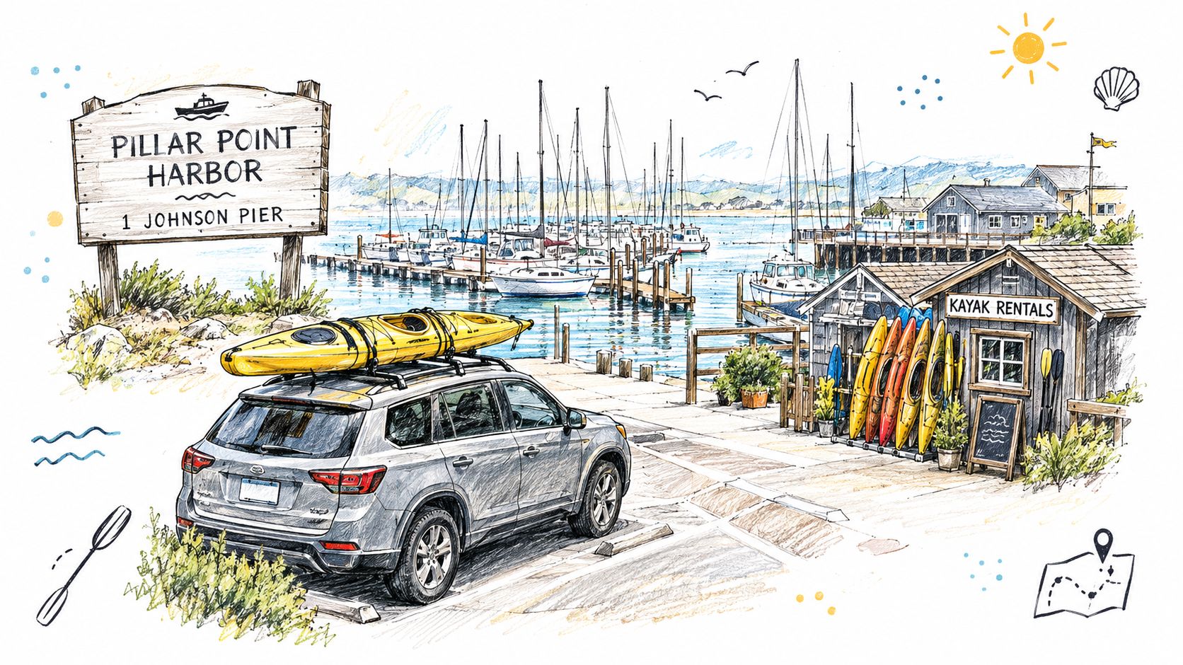
If you're bringing a trailered craft, distinguish the public launch ramp from the rental operation. The Pillar Point Launch Ramp guide identifies the ramp at Pillar Point Harbor Boulevard, Half Moon Bay, CA 94019, with six lanes, four dock fingers, and a $15 launch fee (Bay Area launch-ramp guide). That fee applies to the listed launch-ramp access, not automatically to every visitor parking at the harbor.
Half Moon Bay Kayak Company's posted hours are 9 a.m. to 5 p.m. from May through September, with the last renters going on the water at 4 p.m. From October through April, hours are 10 a.m. to 4 p.m., with the last renters on the water by 3 p.m. The company is closed on Tuesdays (Half Moon Bay Kayak Company operating hours).
A rental is the sensible choice for most visitors. Ask specifically for the protected inner-harbor route, confirm what clothing is available, and call before driving down on a foggy or windy morning. Rental staff can delay or restrict departures when conditions deteriorate. For comparison, travelers planning paddling trips elsewhere can browse regional kayak rental spots in Florida, but Half Moon Bay requires a more careful cold-water and swell conversation than a warm-water destination.
The harbor has practical amenities close to the pier, including restrooms and places to buy food from the working waterfront. Watch the posted hours rather than assuming a late launch will be supported.
Reading the Water Before You Paddle
A calm-looking harbor isn't enough information. The outer side of the breakwater is exposed, and conditions can change quickly around the entrance. Local guidance emphasizes checking the forecast, tide chart, route, and emergency exit plan before launch, while beginners should remain within swimmable shoreline distance and avoid high wind or open-ocean conditions (practical Half Moon Bay ocean-kayaking guidance).
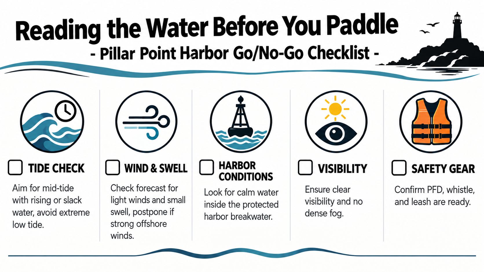
Use this short go-or-no-go routine:
- Check the tide: Favor a manageable tide with a rising or slack-water feel. Extreme low water can expose mud and kelp, while moving water near structures can complicate a beginner's return.
- Read wind and swell together: Wind, swell, and cold-water exposure are the primary technical risks, not the length of the route. Regional conditions can include 4 to 5 foot surf and offshore or variable winds, so don't treat a flat inner harbor as proof that the coast is mild (San Mateo County Harbor District event guidance).
- Look at the harbor mouth: If waves are breaking or piling up at the entrance, stay inside. The breakwater is a boundary, not a challenge to cross.
- Confirm visibility: Dense fog makes navigation and communication harder, particularly for families trying to keep several boats together.
- Secure safety equipment: Wear the PFD, carry a whistle, and ask about a paddle leash. Keep your emergency exit in mind before you leave the launch.
The water temperature is the part visitors most often underappreciate. Pacific water around Half Moon Bay remains about 50 to 60°F year-round (Local Getaways' coastal conditions overview). If you capsize, the problem isn't merely being wet. Cold water can shorten your useful response time, especially when a child or an inexperienced paddler is involved.
Go/no-go rule: If the wind is building, the seas are unsettled, or you can't identify an easy return to shore, keep the trip inside the protected harbor or postpone it.
For another Sonoma County coastal planning reference, compare the decision-making approach with Doran Beach camping, where weather and shoreline conditions also shape the day.
Best Routes for Beginners and One Option for Experienced Paddlers
Pillar Point offers two very different experiences, and treating them as interchangeable is the mistake to avoid. The inner harbor rewards conservative planning. The outer coast punishes casual confidence.
The protected harbor loop
For a first outing, stay inside the breakwater and follow the inner side of the west structure toward the east basin. The route keeps the launch area visible and gives you repeated opportunities to turn around. Sea lions may be resting on rocks near the breakwater, but wildlife is a reason to slow down, not a reason to approach.
Rental staff can point you toward this loop because it matches the equipment and experience level of most visitors. The harbor is the place to learn how the kayak turns, how a tandem boat responds when paddlers work at different speeds, and how your group communicates on the water.
The outer-coast option
Experienced paddlers can consider launching from the Pillar Point or Princeton Harbor side and heading north along the outer beach toward Pillar Point Reef. This is an open-water route with surf exposure, possible currents near the harbor entrance, and no guarantee that a retreat will feel simple once conditions change.
| Factor | Pillar Point Harbor Loop | Outer Coast to Pillar Point Reef |
|---|---|---|
| Water type | Protected harbor water | Exposed ocean |
| Best for | First-timers, families, rental users | Skilled paddlers with self-rescue ability |
| Main concern | Wind entering the harbor | Surf, swell, currents, and cold-water immersion |
| Return plan | Frequent sightlines to launch | Requires a deliberate exit and turnaround plan |
| Equipment mindset | Sit-on-top kayak and PFD | Advanced sea-kayak judgment, suitable insulation, and rescue skills |
The outer route is not a casual upgrade from the harbor loop. It belongs to paddlers who already handle swell, understand surf landings, and can perform self-rescue in cold water. Sonoma County paddlers who want to turn a group outing into a more structured private event can also review Kunde Winery private group experiences, though a winery gathering should remain separate from the water-safety decision.
Wildlife and Views You Can Expect From the Kayak
The protected harbor gives you a close, working-waterfront perspective rather than a guaranteed wildlife spectacle. The most dependable sighting is the California sea lion. They may haul out on breakwater rocks or move through the harbor near the launch, and their barking can make the setting feel much wilder than the short paddle suggests.
Harbor seals are another possibility, especially around quieter parts of the marina. They're generally shyer, so the best encounter often consists of a head appearing briefly above the water before disappearing. Keep the kayak pointed on its course and let the animal decide how close it wants to be.
What the waterline reveals
Brown pelicans, cormorants, and western gulls use the harbor and shoreline. At lower water, great blue herons can stand in the shallows, often looking completely still until they make a sudden move. These are realistic expectations for a family trip. Nobody needs a species checklist to enjoy the view from water level.
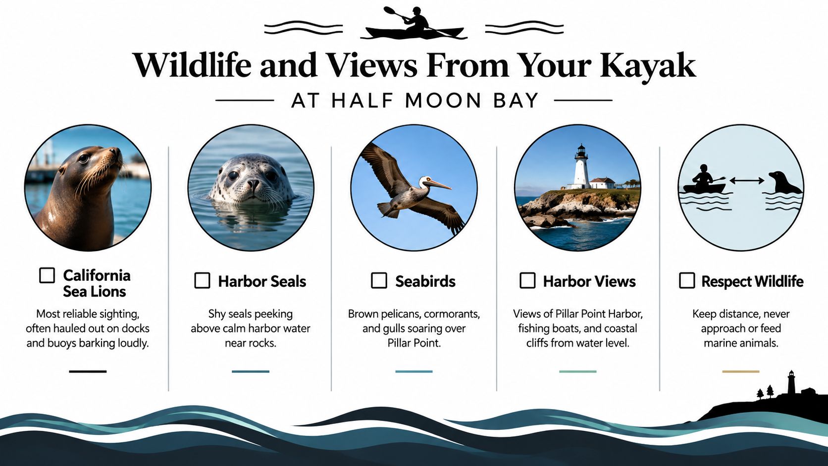
From a kayak, the scenery changes in small but satisfying ways. You'll see the breakwater from the inside, the fishing fleet at the marina, and the bluffs of Pillar Point behind the beach when visibility is clear. The harbor's working boats, docks, and low shoreline create a better sense of place than a quick overlook visit.
Winter can bring the possibility of gray whales offshore. Harbor porpoises are less common and may appear just beyond the harbor mouth, but neither should shape your launch decision. A day with no whale sighting can still be a successful harbor paddle.
Bringing children without overreaching
Outfitters commonly discuss young riders in terms of roughly age 5 and up in a tandem with a parent and age 10 and up in an individual kayak, but confirm the operator's current age, height, and weight requirements when booking. Don't guess at those thresholds, because the right boat and staffing decision depends on the child and the rental company's policy.
For a child's first paddle, keep the entire trip inside the breakwater. The dock should remain visible, the route should stay short enough to reverse easily, and an adult should have a clear plan for what happens if the child becomes cold, tired, or nervous.
For parents: A flat harbor day is more memorable than an ambitious route that leaves everyone cold and anxious.
The water stays cold enough that clothing deserves as much attention as the kayak. A wetsuit is especially important from spring through early fall, and children who chill quickly should have a full spring suit or equivalent insulation arranged before launch. Even when the air feels comfortable, immersion changes the situation immediately.
Pack dry layers, water, and snacks. Restrooms and food options near the harbor reduce the friction of the outing, and the short paddle makes it easy to finish with lunch rather than pushing children through one more unnecessary loop.
Your Day-Trip Plan in One Pass
Start in Sonoma County early enough to get through the Bay Area before traffic becomes the main event. Petaluma is the quickest county departure point, while Santa Rosa, Sebastopol, Healdsburg, and Sonoma need a little more planning because they feed into US-101 before the CA-92 crossing.
Aim to arrive at Pillar Point Harbor by 10 a.m. Check in, confirm the rental window, and spend five minutes looking at wind, tide, visibility, and the harbor entrance. If the entrance is breaking or the forecast is deteriorating, make the decision before you're on the water.
Keep the route inside the breakwater for a first visit. A short harbor loop gives everyone time to settle into the boats, and you can return to the launch without turning the paddle into an endurance event. Eat at the harbor afterward, use the restroom before the drive, and leave enough daylight and energy for the trip home.
A small-craft advisory cancels the plan. A south swell over 4 feet is a reason to keep the outing strictly inside the harbor, based on the regional conditions guidance (San Mateo County Harbor District paddle-event document). Fog can also change the experience, so don't assume a familiar forecast means familiar visibility.
Use this guide to day trips from San Francisco when combining Half Moon Bay with other coastal stops.
Before leaving the parking lot, check the essentials:
- PFDs: Everyone wears one on the water.
- Cold-water clothing: Rent or bring appropriate insulation.
- Route: Stay inside the harbor unless you're equipped and qualified for exposed water.
- Communication: Carry a whistle and agree on a regroup point.
- Supplies: Pack water, snacks, dry layers, and a post-paddle meal plan.
- Parking and launch details: Follow the operator's instructions and bring the payment method needed for any applicable launch fee.
If you're planning a Half Moon Bay paddle from Sonoma County, book or call the rental operator, check the marine forecast on the morning of the trip, and choose the protected harbor without apology. For more local trip planning, subscribe to Sonoma County Navigator for practical guides, coastal outings, and day-trip ideas that start close to home.

Sign up for Sonoma County Navigator
Discover Sonoma County! Latest News, places to play, stay, eat, live, shop, learn and more!
No spam. Unsubscribe anytime.